Cloud PointField Guide

Mid cloud — genus

Altocumulus

Mid-level cloudlets in patches and waves

Written by Laurence WayneEntry No. 36Common

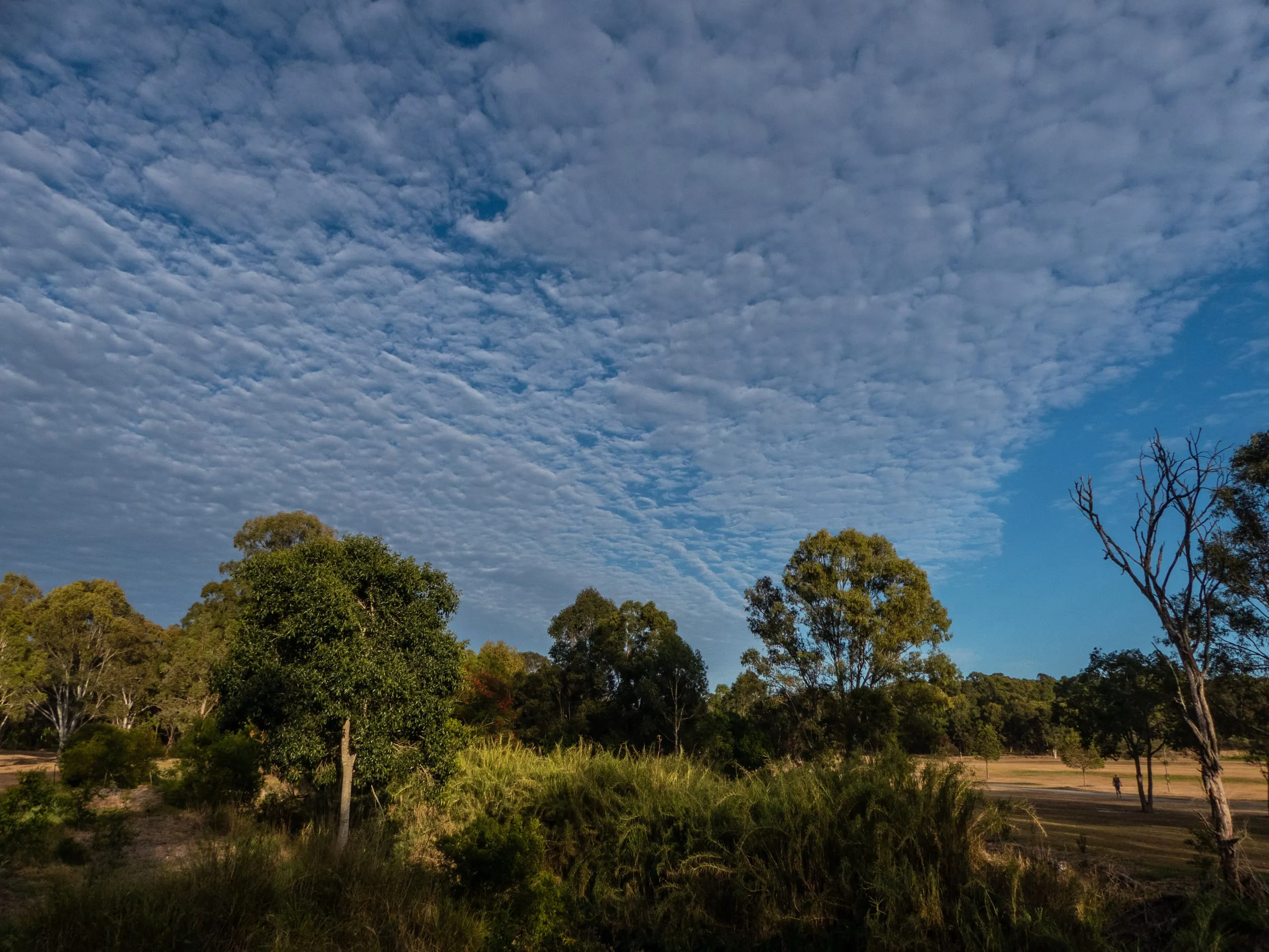
Altocumulus: Mid-level cloudlets in patches and waves
Plate XXXVIPhotograph by John Robert McPherson, CC BY-SA 4.0.

Altocumulus is a white or grey patch, sheet or layer of cloud made up of rounded masses or rolls, the individual cloudlets typically a finger to three fingers wide held at arm's length. It usually forms when a moist layer of air is gently lifted and overturns into regularly arranged convective elements, often ahead of an approaching front. A morning sky full of altocumulus on a warm, humid day can precede afternoon thunderstorms.

Worth knowing

  • If a cloudlet is smaller than your thumb at arm's length, it's likely cirrocumulus; if larger, it's altocumulus.
  • Altocumulus lenticularis (lens-shaped) clouds are often mistaken for UFOs!
  • These clouds create the beautiful 'corona' effect - colorful rings around the Sun or Moon.
  • Some varieties look like castle turrets - these are called 'altocumulus castellanus'.
Note

Still unsure it's the same cloud? Our app, Cloud Point— on iOS and Android — reads a photo and returns the likely type with altitude, useful when a formation is fading faster than you can look it up.
Test yourselfThree levels

Choose a difficulty

What does altocumulus look like?

  1. aA single flat, featureless grey sheet
  2. bA patchwork of small rounded cloudlets — a 'mackerel sky'
  3. cA towering, anvil-topped storm cloud
  4. dWispy white hair-like streaks
Show answer

AnswerA patchwork of small rounded cloudlets — a 'mackerel sky'

Altocumulus appears as a layer broken into many small rounded masses or rolls.

Why do altocumulus cloudlets form in such regular rounded clumps?

  1. aAircraft contrails spreading out
  2. bGentle overturning convection within a lifted moist layer
  3. cPollution trapped near the ground
  4. dLightning reshaping the cloud
Show answer

AnswerGentle overturning convection within a lifted moist layer

A lifted moist layer overturns into regularly arranged convective elements, giving the rows of cloudlets.

The WMO separates altocumulus from cirrocumulus by the apparent size of the cloudlets. What is the rule of thumb?

  1. aThere is no size rule; only colour distinguishes them
  2. bAltocumulus cloudlets look wider than about 1° (a little-finger width at arm's length); cirrocumulus elements are smaller
  3. cCirrocumulus cloudlets are always the larger of the two
  4. dAltocumulus is judged in kilometres and cirrocumulus in metres from the ground
Show answer

AnswerAltocumulus cloudlets look wider than about 1° (a little-finger width at arm's length); cirrocumulus elements are smaller

By WMO definition cirrocumulus elements subtend less than about 1°, while altocumulus cloudlets are larger (roughly 1° to 5°) — a finger held at arm's length is the field test.

Nearby in the guide